Input Variable Maps Jurisdictional and Other
13 Results
Conservation Partners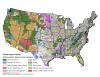 |
Primary conservation partner from the PADUS based on area managed. |
Federal Ownership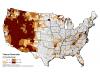 |
Percentage of county area in Federal ownership. |
Fire Stations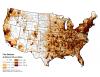 |
Number of fire stations per 100 sq. miles. |
Firefighter Injuries Reported (Total Number)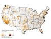 |
Total number of firefighter injuries reported. |
Forest Mechanical Treatment Potential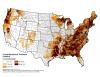 |
Sum of area available for mechanical treatment in forest. |
Landscape Classes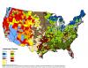 |
Landscape resiliency class. |
Non-forest Mechanical Treatment Potential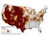 |
Sum of area available for mechanical treatment in non-forest. |
Percentage of Hotspots in PADUS Lands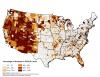 |
Percentage of hotspots in PADUS lands. |
Protected Areas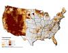 |
Percent of County area that is protected land or managed by a conservation partner. |
Response Persons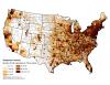 |
Number of first responders per 100 square miles. |
Roaded Area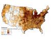 |
Percent of county within 540 m of roads. |
Wilderness or Inventoried Roadless Areas (Acres)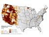 |
Acres in wilderness or inventoried roadless areas. |
Wilderness or Inventoried Roadless Areas (County Area)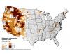 |
Percent of county in wilderness or inventoried roadless areas. |